
Property Details - Reference 71052

Overview
Advert Type:
Social Housing.
Landlord:
Sheffield City Council.
Closing date:
01/07/2025.
Added:
26/06/2025.

Icon section
Main details
Property Reference:
71052.
Area:
Netherthorpe.
Number of Bedrooms:
1 Bed.
Property type:
Flat.
Floor:
1st floor.
Letting band:
Mobility Need or Medical Acknowledgement.
Closing Date:
01/07/2025.
Upper or lower level:
Upper Level.
Energy Efficiency Rating:
C (69-80).
Energy Efficiency Rating %:
76%.
Applicable policy:
Sheffield City Council Policy.
Cost
Rent:
£88.28.
Heating & Hot Water Standing Charge:
£6.28.
Water Rates:
£13.59.
Tenants Association Contribution:
£0.10.
City Wide Alarm Charge:
£4.28.
Wardens Service Charge:
£1.76.
Management Service Charge:
£12.80.
Total cost of all charges (including rent):
£127.09.
Payment cycle :
Weekly (50 weeks).
Facilities
Accessibility Types:
Level access to the property.
Parking facilities:
Parking within 25 metres.
Door Entry System:
Yes.
Sheltered:
Yes.
City Wide Alarm:
Yes.
Heating type:
District Heating.
Double Glazing:
Yes.
Garden type:
Communal garden.
Property Bedroom 1:
Bed 11 to 15 sq mtrs.
Bathroom Types:
Level access shower / wet room.
Bedroom Sizes:
1.
Eligibility details
Minimum Bedroom need:
1.
Maximum Bedroom need:
1.
Max number of household members:
3.
Minimum age of all household members:
60.
Minimum age of eldest applicant:
60.
Further information
This property is still being repaired, it will be ready for letting shortly.
The bathroom has a level access shower.
This block has a communal entrance and a fob entry system.
Shops
800 m to Tesco supermarket on West Street
1 km walk into town
Post Office and takeaways 50m away.
GP surgery
Devonshire Green 400m
Buses
bus stop 100m away
Tram 300m away
Other info
Communal garden
.
Media
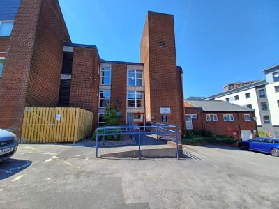
Front view
Item 1 of 8
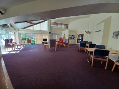
Communal Lounge
Item 2 of 8
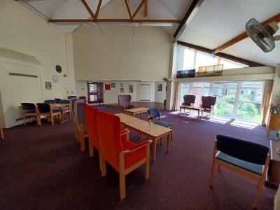
Communal Lounge
Item 3 of 8
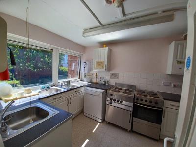
Communal Kitchen
Item 4 of 8
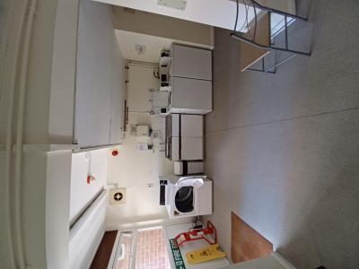
Communal Laundry
Item 5 of 8
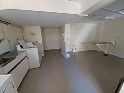
Communal Laundry
Item 6 of 8
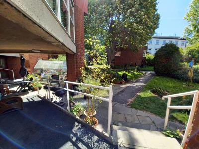
Communal Garden
Item 7 of 8
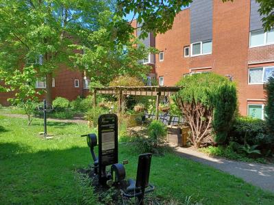
Communal Garden
Item 8 of 8
Local area
Netherthorpe
Visit the links below to find out more about the local area.Map
Below is a map showing this property's location. You can find more information about this property in the 'Overview' tab. Skip past the mapMap references should be used as a guide only and do not indicate the precise location of the property
Contains Ordnance Survey data © Crown copyright and database right 2015.